


Trainsity Kuala Lumpur LRT KTM
Descrição do Trainsity Kuala Lumpur LRT KTM
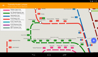
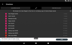
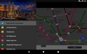
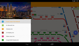
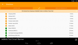
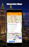
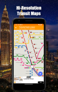
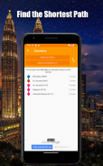
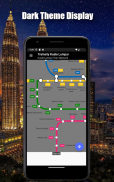
Percorra a cidade de Kuala Lumpur usando os mapas vetoriais de alta resolução das linhas KTM Komuter, RapidKL e KLIA Express Rail Link, incluindo a linha BRT Sunway. Os mapas têm pegadas de tamanho de arquivo pequeno, mas com muitos níveis de zoom e podem funcionar offline sem conectar-se à Internet. Os usuários podem clicar nos rótulos da estação de trem para abrir o Google Maps ou o Street View, onde podem usar todas as funções dos aplicativos do Google para visualizar a área circundante e / ou executar rotas para obter instruções. Há também uma função offline para calcular a melhor maneira de viajar de uma estação para outra estação com uma discriminação de direção e horários (que podem variar do tempo real de viagem).
* Agora com o modo escuro
Trainsity Kuala Lumpur LRT KTM - Versão 2.10.0
(15-01-2025)Trainsity Kuala Lumpur LRT KTM - Informações do APK
Versão do APK: 2.10.0Pacote: com.dom925.trainsity.kualalumpurÚltima versão de Trainsity Kuala Lumpur LRT KTM
Outras versões


 4.1
4.1


Apps na mesma categoria

Você também poderá gostar...


